|
|

|


|
Hoxton Hall Theatre, 130 Hoxton Street, London, N1 6SH
Hoxton Hall is south of the site of Holly House and north of that of Hoxton House
Maps of the Hoxton madhouses
This sketch map of
Hoxton Street
and its neighbourhood was adapted by
Lilian Billows from Roque's 1745 map of London, to show the sites of the
madhouses and almshouses in the area. It is taken from Tis a Mad World
at Hogson. A Short History of Hoxton, published by
Hoxton Hall
in 1974.
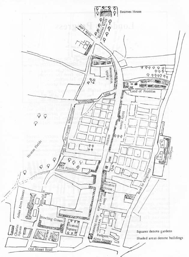
James
Parkinson
lived at 1 Hoxton Square, which is
the end house in the south west of the square. The short road leading out
of the square on the north east is
MundayStreet. The present
34 Hoxton
Street, the only surviving part of Hoxton House asylum, was
built on
the site of the Jews Burial Ground. It may mark the southern limit of the
asylum at its greatest extent. On this map, Hoxton House is shown as far
north as The Pimlico, which is the site the Britannia Theatre was
built on in 1858. The plaque for the Britannia Theatre is opposite 74
Hoxton Street.
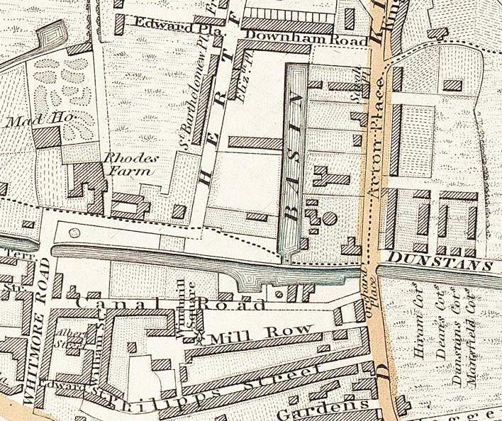
This section from
Greenwood's 1830
map
shows
Whitmore (Balms or Baume's)
House,
Warburton's house for rich patients. De Beavoir Town now occupies the site,
but the name Whitmore Road, Downham Road and Dunston Road remain
This section from
Greenwood's 1830
map
shows
Holly House,
the house owned by the Burrows family that was used by the Guardians of
Shoreditch Workhouse. The workhouse is now St Leonard's Hospital. The
"lane" on the other side of the road to Holly House is Ivy Lane, now Ivy
Street. Part of Hare Walk survives. The Ironmongers Almshouse is now the
Geffrye Museum.
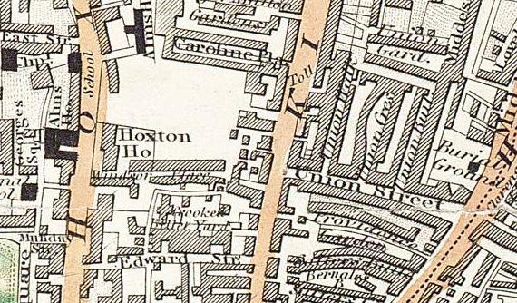
This section from
Greenwood's 1830
map
shows
Hoxton House. Its
is not far north of Mundy Street, the street leading from Hoxton Square.


 Click coloured words to go where you
want
Click coloured words to go where you
want